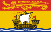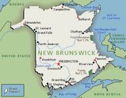

New Brunswick is one of Canada's three Maritime provinces. It is bordered by Quebec to the north, Nova Scotia and the Atlantic Ocean to the east, and the US State of Maine to the south and west. The provincial capital is Fredericton and the largest city is Saint John.
The province's name comes from the English and French translation for the city of Braunschweig in north Germany (and former duchy of the same name), the ancestral home of the Hanoverian King George III of the United Kingdom.
New Brunswick in Southern Victory[]
New Brunswick was a Canadian province. During 1838-39, a number of clashes known as the Arrostook War took place over the border between the US state of Maine and New Brunswick over the exact position of the border. The end result was the Webster–Ashburton Treaty, which was not to Britain's satisfaction.
In 1881, during the Second Mexican War, a combined British and Canadian Army crossed the border from New Brunswick and invaded Maine. The invasion had two purposes: first, to settle the Maine and New Brunswick border once and for all, and; second, to humiliate US President James Blaine (who hailed from Maine) in order to bring about a final conclusion to the war. The US Army in the region was defeated and driven south, and the Anglo-Canadian forces seized the upper St. John and Aroostook River valleys. As part of the peace treaty ending the war, the US was forced to relinquish this territory to Canada, and it became part of New Brunswick.
In 1914, during the Great War, the US Army invaded New Brunswick, and in 1917, when Canada was occupied by the U.S., the territory it had gained during the Second Mexican war was returned to Maine along with additional territory from New Brunswick. The rump province had a border with the newly founded Republic of Quebec.
New Brunswick, along with all of Canada, was still under US occupation in 1945.
New Brunswick in The Two Georges[]
New Brunswick was a province of the North American Union. It bordered Massachusetts, Quebec, New Scotland, and the Atlantic Ocean.[1]
References[]
- ↑ Map The Two Georges, frontispiece.
| ||||||||
| |||||
| |||||||||||||||||||||||||


