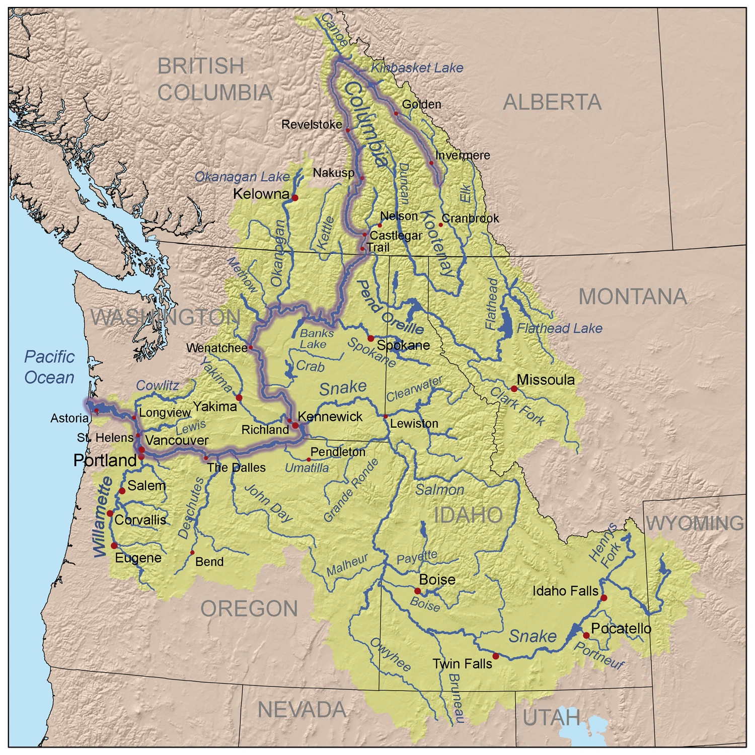
The Columbia River is the largest river in the Pacific Northwest region of North America. The river rises in the Rocky Mountains of British Columbia, Canada. It flows northwest and then south into the U.S. state of Washington, then turns west to form most of the border between Washington and the state of Oregon before emptying into the Pacific Ocean. The river is 1,243 miles (2,000 km) long, and its largest tributary is the Snake River. Its drainage basin is roughly the size of France and extends into seven U.S. states and a Canadian province.
By volume, the Columbia is the fourth-largest river in the United States; it has the greatest flow of any North American river draining into the Pacific. The river's heavy flow and its relatively steep gradient gives it tremendous potential for the generation of electricity. The 14 hydroelectric dams on the Columbia's main stem and many more on its tributaries produce more hydroelectric power than those of any other North American river.
Columbia River in Supervolcano[]
After the Yellowstone Supervolcano eruption, Los Angeles still had fairly reliable electricity until all the ash and other debris filled the Columbia River and damaged the various hydro-electric turbines. This resulted in rolling black-outs with L.A. having power for only a few hours a day, a few days a week.[1]
References[]
- ↑ All Fall Down, pg. 197, HC.
| |||||||||||||

